Search Our Content Library

Learning Path Courses:

  • Using Terrain in MicroStation CONNECT Edition

    In this course, you will learn to visualize imported point data on the earth surface and display Contours, Triangles, Voids, Islands, Flow Arrows and many other Terrain Features. You also will learn to label Contour and Spot Elevations.

    Brand

    MicroStation

    Products

    MicroStation

Like what you see? We’d love to give you a guided tour of the best Pinnacle has to offer.

Book Your Demo

Trusted By Leaders

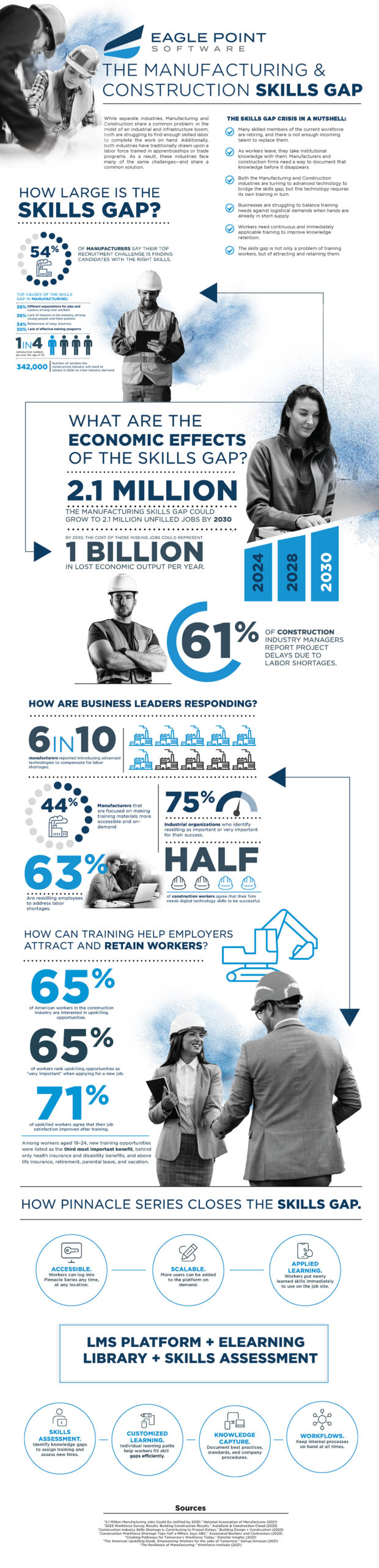
Understanding the Manufacturing & Construction Skills Gap
Before You Go

Understanding the Manufacturing & Construction Skills Gap

We went deep into the latest market research and created a resource to give you fresh insight into your recruitment challenges.